Sunday, August 12, 2018

The Race: Eating an Elephant

How do you eat an elephant? One bite at a time.

That's the perspective we took for the MR340 race. We broke down the race into twelve 16-50 mile increments comprised of miniature goals. At each increment, each bite of the elephant, we celebrated with a pickle pop and 5-10 minute use of our cell phones. This mental trick helped us accomplish our goal: completing the MR340! Here are the "bites" of our elephant, with mandatory checkpoints indicated by a *

          Kaw Point*     (river mile 367)
          Lexington*     (river mile 317)
          Waverly*     (river mile 294)
          Miami     (river mile 262)
          Glasgow     (river mile 226)
          Franklin     (river mile 196)
          Katfish Katys     (river mile 179)
          Noren*     (river mile 144)
          Chamois     (river mile 118)
          Hermann*     (river mile 98)
          New Haven     (river mile 82)
          Klondike*     (river mile 56)
          St. Charles*     (river mile 29)

We stopped at other boat ramps not listed above, and we didn't stop at all of the boat ramps listed above. The 'bites' served only as a mental trick to accomplish eating our large elephant: 340 miles on the Missouri River. So, here's our story of the MR340:


Tuesday, July 24, 2018
Total travel distance: 126.4 miles
Total travel time: 8:00 a..m. to 3:00 a.m. (19 hours)
Average Pace: 6.65 mph
Location: Kaw Point (start) to Dalton Bottoms
Temperature: High = 92 degrees
                      Low = 60 degrees
Checkpoints: Kaw Point 8:00 a.m.
                      Lexington 3:07 p.m.
                      Waverly 6:24 p.m.
All boat ramps: Kaw Point, Riverfront park, La Benite, Cooley Lake, Fort Osage, Lexington, Waverly.

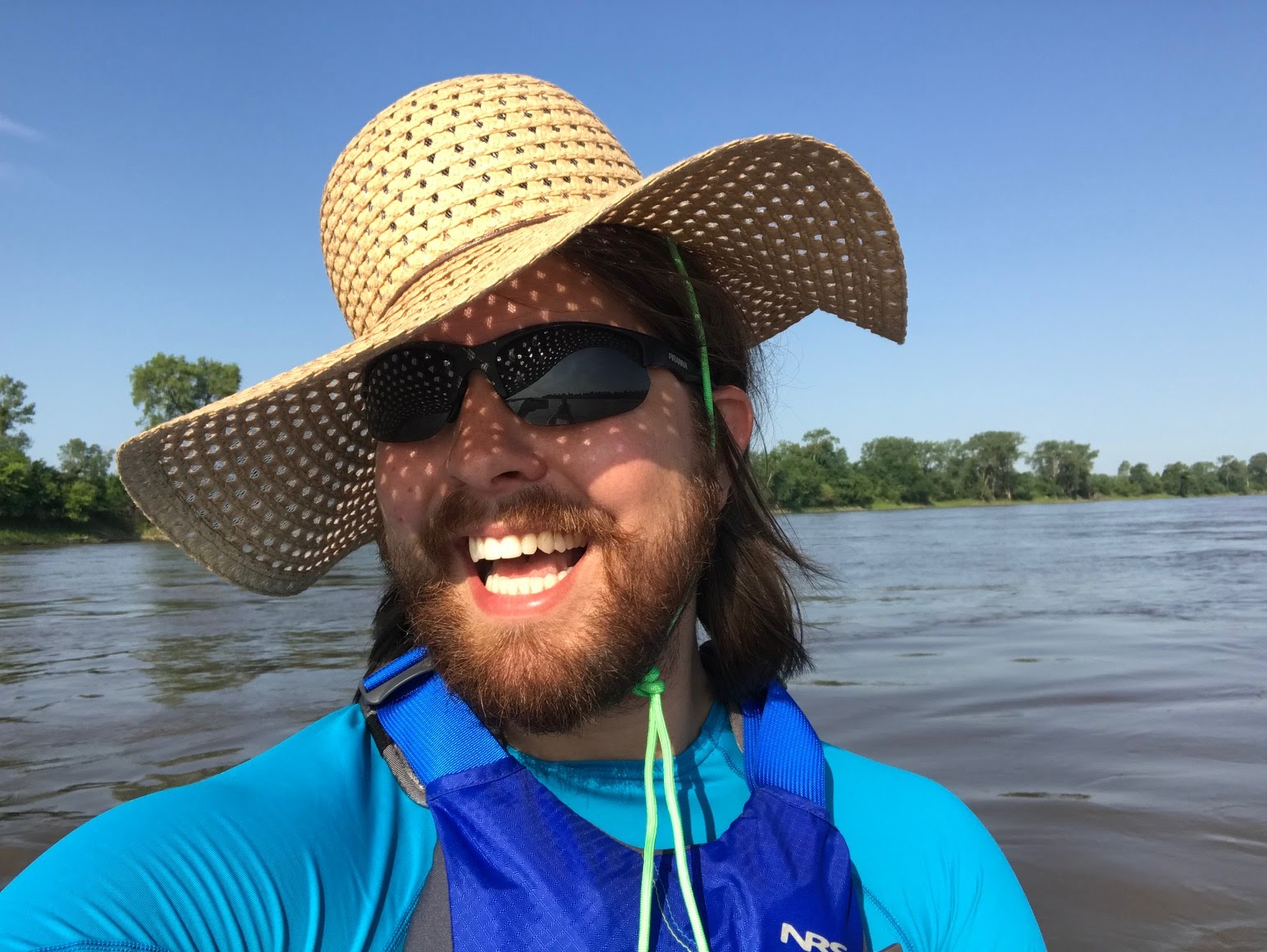
First day of the race! The evening before the race we attended the mandatory safety meeting, dropped off Honeybee at the start of the race, and had a delicious dinner with Danielle's mom and dad at Brown & Loe. The morning of the race, we arrived at Kaw Point around 6:30 a.m. and began packing Honeybee for the race. We watched the individual racers start at 7:00 a.m. We got on the Kaw River around 7:30 a.m. and waited for the race to begin at at 8:00 a.m.

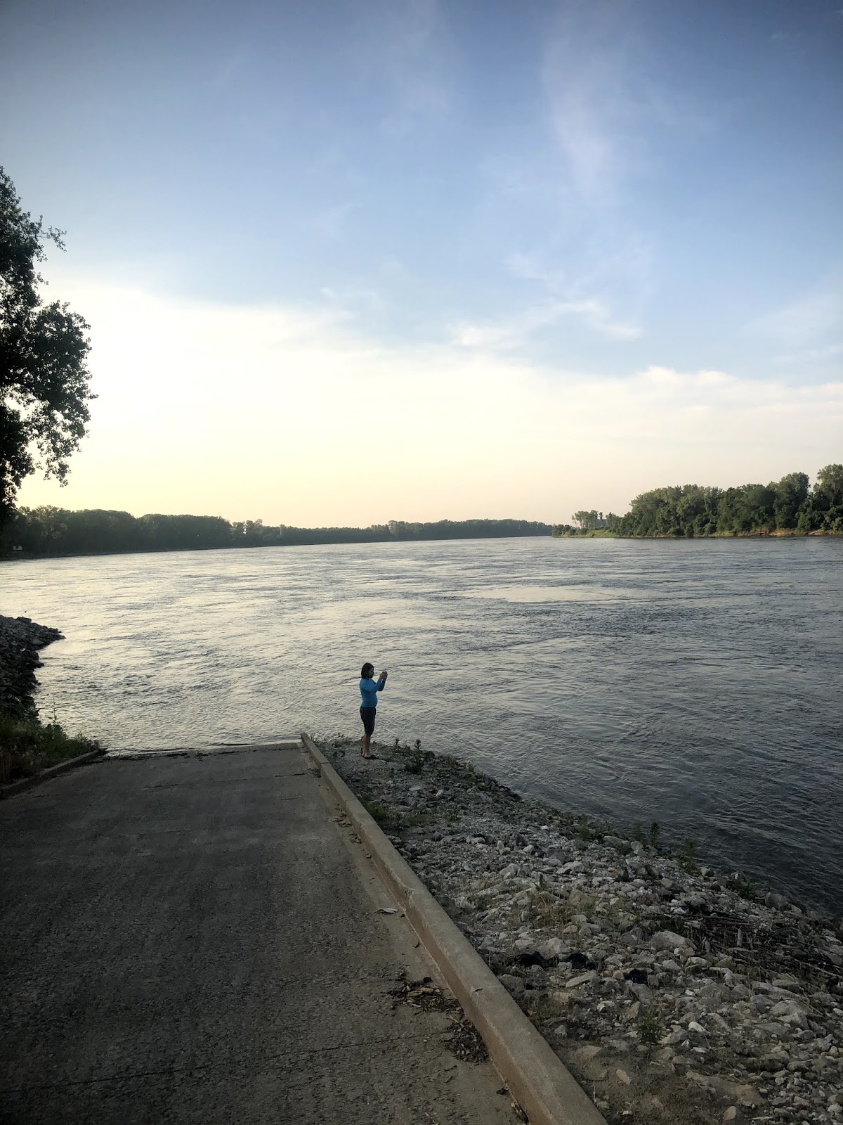
We started the race strong. We intended to get to Glasgow (we didn't) within the first day. We passed our very first barge! Passing a barge isn't difficult, it's the wake for the next 5 miles that becomes difficult. Overall, this was a good day. We stopped at Waverly and met our ground crew, Rebecca, and Danielle's parents. We refueled at Waverly and prepared to paddle late into the night. The plan was to paddle until we could paddle no more.

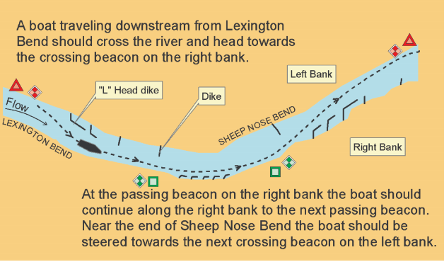
This first night, there were enough boats that we could follow the line of boats back and forth along the channel of the river. If you will recall, going straight down the river is not efficient; we must follow the channel, back and forth across the Missouri River.  We didn't need to see the river markers this first night. The moon was bright and there were enough boats on the river that we all formed a line and followed one another back and forth across the river, staying in the channel. Although we intended to get to Glasgow, the night brought cold weather. Our energy was running low and we were cold and wet. At one point, Danielle dropped her paddle in the river. She quickly stuck her hand into the water and recovered the paddle, but it was a sign that exhaustion was taking a toll on us. (Don't worry: we had two spare paddles on board!) We exited at Dalton Bottoms (about 12 miles from Glasgow) around 3:00 a.m. We laid out our tarp and wrapped ourselves individually in our safety blankets: foil burritos on the shore of Dalton Bottoms. Many other paddlers stopped here, and we were familiar with the stop because of our training paddle from Dalton Bottoms to Franklin in June. Dalton Bottoms is in the middle of nowhere. Traveling by car, it would take you 20-30 minutes through cornfields to arrive at Dalton Bottoms. There were about fifty other paddlers at Dalton Bottoms - with a total of two primitive toilets.

IT WAS SO COLD THAT NIGHT. We unloaded every piece of clothing we had in the canoe and layered ourselves to keep warm. Neither of us anticipated such a cold night, and were incredibly thankful for our safety blankets. Our exhaustion lured us to sleep around 3:30 a.m.

Around 4:30 a.m. we awoke to a paddler on the river yelling "Are there any MR340 volunteers here? I'm so cold. Is this Glasgow? I'm so cold. My phone died. I'm so cold. My son is waiting for me at Glasgow. I'm so cold. This is a medical emergency. I'm so cold. I'm dying. I'm so cold." This paddler was likely experiencing hypothermia and, thankfully, the MR340 volunteers were available to aid him. His experience, however, was a wake up call that. although fun, the MR340 comes with real risks. We tried, unsuccessfully, to get back to sleep.


Wednesday, July 25, 2018
Total travel distance: 95.1 miles
Total travel time: 7:00 a..m. to 12:00 a.m. (17 hours)
Average Pace: 5.59 mph
Location: Dalton Bottoms to Jefferson City
Temperature: High = 90 degrees
                      Low = 62 degrees
Checkpoints: Glasgow 8:52 a.m.
                      Jefferson City 11:53 p.m.
All boat ramps: Waverly, Miami, Dalton Bottoms, Stump Island, Franklin Island, Katfish Katy's, Cooper's Landing, Hartsburg, Marion, Noren (aka Jeff City).

The second day felt like the longest day on the river. We woke in Dalton Bottoms around 6:00 a.m. and emerged from our safety blanket cocoon to find the river covered in fog. There are few things that were drilled into us during training: (1) Do not remove your PFD (Personal Flotation Device, aka life jacket) unless absolutely necessary, (2) Always have a plan A, B, and C, and (3) DO NOT PADDLE IN THE FOG. The MR340 Safety Boat at Dalton warned all paddlers to wait until the fog cleared. Two paddlers decided to get on the river anyway, but quickly pulled off after realizing that they had no visibility. We got back on the water around 7:00 a.m. when the fog finally cleared.

There is not much to do on the river except paddle and stare at the water. This can become extremely boring. We did make an MR340 playlist through Spotify, but music can provide only so much entertainment. We attempted to listen to podcasts, but that didn't work very well because we shared one speaker on a 17.5 foot boat and every so often we would need to communicate about bouys, mile markers, etc., which would interrupt the podcast. The best entertainment was meeting other paddlers. Even if the conversation only lasted for ten minutes as we paddled together, the ten minutes was a welcomed distraction.

We stopped at Franklin Island to refuel and take a short break. Shout out to Trevor Tilton Farmers Insurance Agent who provided free hot dogs, hamburgers, Gatorade, water, snacks, etc. to all the paddlers at Franklin Island. Here is where we made a major mistake: Apparently we did not have enough bug spray on us because we got bit by a lot of bugs. A LOT OF BUGS. We are writing this blog two weeks after the MR340 and our ankles are still recovering from the bug bites.

One of our favorite stops during our trip was Coopers Landing. Coopers Landing is a private boat dock and offers camping, live music, food (including a Thai food truck), and beer. Oh how we wanted a beer, but our reasonableness prevailed. We enjoyed listening to live music, eating dinner, and watching the sunset. A quick note on how bad we smelled: Danielle hopped into Rebecca's car to change her underwear. She was in the car for less than ten minutes. Rebecca's son got in the car about an hour later and asked what smelled so awful. Danielle didn't leave anything in the car - she just sat in the car for ten minutes. We STUNK. We hopped back on the river after dinner and planned to make it to Chamois (52.3 miles from Coopers Landing).

In addition the barges, nighttime is a time where we needed to be 110% alert on the river. The MR340 is always held during a full moon to provide some light during the night. Although we were not completely blind, keep in mind that we were moving between 5-8 miles an hour down the river. If you can only see 20 feet in front of you, and are traveling 5-8 mph, that doesn't allow much time to move out of the way if a bouy, branch, wingdike, etc. comes into your vision. Before the race we were encouraged to download the MR340 Pro Paddler App. The Pro Paddler App shows, in real time, where you are located on the river and where the channel of the river is located. This is incredibly helpful at night when you need to avoid items that won't be in the channel: buoys and wingdikes. We both own iPhones, and the Pro Paddler App doesn't work with iPhones. Our fantastic ground crew captain, Rebecca, let us borrow an old Android. In the haste of getting ready for the race, we never took time to educate ourselves on the Pro Paddler App. We didn't quite understand the benefit, until this second night.

After leaving Coopers Landing and after the sun had set, we met up with a solo kayaker, LaDon. LaDon had the Pro Paddler App (yay!). This second night there were fewer boats on the river, and there was some cloud cover over the moon. We could not simply follow a line of boats in the river channel as we had the first night. Thankfully LaDon allowed us to stay with him, and stay in the channel, during the night. If we had not met up with LaDon we do not know what we would have done to navigate the river that night. At the very least, we would have gone much slower. At the worst, we would have hit a buoy or wingdike and flipped Honeybee.

It was around midnight when we approached Jefferson City. LaDon intended to pull off at Jefferson City. This left us with two options: (1) we could also pull off at Jefferson City, even though it was fairly early in the night, or (2) we could continue on to our intended stop at Chamois (26.1 miles). LaDon told us that there would be a few sandbars between Jefferson City and Chamois where we could stop and sleep - but none of us were sure if the sandbars were underwater given the high water level of the river. We decided to stop at Jefferson City and get a good night's sleep with the intention of pushing hard towards the finish on Thursday. We stopped around 12:15 a.m. (the Chick-fil-a tent at the boat ramp stopped selling food at midnight, boo!). We found a soft spot of grass and rolled up in our safety blankets for our second night as foil burritos.


Thursday, July 26, 2018
Total travel distance: 115 miles
Total travel time: 7:00 a..m. to 12:18 a.m. (17.25 hours)
Average Pace: 6.67 mph
Location: Jefferson City to St. Charles (finish)
Temperature: High = 87 degrees
                      Low = 61 degrees
Checkpoints: Hermann 1:56 p.m.
                      Klondike 8:27 p.m.
                      St. Charles 12:18 a.m.
All boat ramps: Noren (aka Jeff City), Moreau, Bonnots Mill, Mokane, Chamois, Portland Access, Gasconade Park, Hermann, New Haven, Washington, Klondike, Weldon Spring, Frontier Park (aka St. Charles)

We awoke around 6:00 a.m. and were surprised to see there was no fog on the river! We packed up and headed out. Although we were hopeful to finish the race today, we also did not know what surprises lay ahead of us. As soon as we got on the river we hit a barge, which means we hit a delay.

We stopped in Chamois and met Rebecca. Chamois is a campground - with showers, porcelain toilets attached to a sewer, and sinks! Although we did not shower, we had the opportunity to use a 'real' toilet and wash our faces/teeth in a sink with running water! After two days on the river this was a welcomed break. We continued paddling and planned to stop at New Haven.

Then, the rain began. Our lightning app on our phone notified us that there was lightning in the area, but we didn't see any. We heard the thunder, but didn't see any lightning. We discussed whether we should pull off the river and decided we would only pull off the river if we saw lightening. It rained, and rained, and rained. It was a cold rain. Typically, an MR340 paddler may take a dunk into the Missouri River to cool down if they feel like they may be overheating; the river is usually colder than the air. However, during the rain, Danielle used the river water to warm up her hands; the river was warmer than the rain and the air. All the rain gear was with our ground crew; we had not expected rain. Our clothes became soaked. Lesson learned.

The rain started to let up just outside of Hermann. We planned to push to New Haven (another 16.3 miles) but we saw smoke from a food tent set up at Hermann. We were hungry, cold, and wet. We decided to stop, get something to eat, and change into dry clothes. This provided the extra benefit of changing into non-stinky clothing. (and THANK YOU Rebecca for washing our stinky clothing before we finished!). Due to this unexpected stop, we decided we would make every attempt to finish this race without stopping again: 68.7 miles.

As we got back on the river, a safety boat came up to us and commented to us "looking good, you might move over a bit more, but you're in a good spot." We thought such a comment was odd. We were over 250 miles into the race, why was the safety boat commenting on our paddling skills now? About that time we ran into LaDon, who noted the large barge behind us. It clicked - the safety boat was noting the barge, which we had not seen because it was behind us! This was the largest barge we'd see on the river. We discussed pulling off the river instead of riding it out. It was SO BIG. We 'hid' from the barge near the wingdikes. We became anxious as the barge approached us. Then, as it passed and, nothing. No large wake. Why? this barge was traveling down river, not up river. Every other barge we'd encountered was traveling up river, against the current. This down river barge didn't cause a large wake because it was traveling with the water, not against it. We were relieved!

We ran into two other guys and mentioned to them that we hoped to be in Klondike by 8:30 p.m. They said "if you stay with us, we'll be there by 8:00." Okay! As we approached Klondike, the two men we were following got off the river. We saw three boats getting on the river at Klondike and paddled quickly to reach up to them before the sun set. Remember, it was getting dark, we needed someone to paddle with (that hopefully had the Pro Paddler App). The three boats were comprised of: two men in a canoe leading the charge with the Pro Paddler App, two men in another canoe, and a single man in a kayak. They planned to finish the race this night, and so did we.

About an hour after leaving Klondike we received a text from the MR340 organizers stating that Klondike was covered in fog and reminding paddlers to not paddle in the fog. We were thankful that we had not stopped in Klondike. We continued paddling and mentioned how awesome it was that we were going to finish the MR340. This was the first MR340 for all seven of us. Our excitement grew.

About ten miles outside of St. Charles we hit fog. We were SO close to the finish. The two guys in the canoe leading the rest of us told us to keep close and keep paddling. Our thought: if they hit a buoy, wingdike, etc., we would hopefully have enough time to avoid the obstacle because we were traveling behind them. We slowly, and cautiously, continued forward. The fog lifted within twenty minutes or so. Then, we saw it: Frontier Park, the FINISH LINE!

We paddled to the finish line and were greeted by friends and family at 12:18 a.m. on Thursday night/Friday morning: 64 hours and 18 minutes after starting the race. WE DID IT!


LIGHTNING ROUND QUESTIONS!
1. What was the best part of the race?
         Danielle: Finishing. And I saw two of the most beautiful sunsets of my life.
         Jeffrey: Evenings on the river - enjoying the sunset and relaxing on calmer waters while anticipating the moonlight paddling ahead.

2. What was the worst part of the race?
         Danielle: The cold. And the boredom of paddling, paddling, paddling.
         Jeffrey: I don't know.

3. Would you do it again?
          Danielle: Yes! I think it would be fun to do in a peddle-boat next year! I also recently learned of the Yukon 1000. 40th Birthday Goal?!?! Who wants to do the Yukon 1000 with me!??!?!
          Jeffrey: Definitely! Hearing stories from multi-year MR340 veterans, we learned how different the race is each year. River levels and weather conditions are game changers beyond our control, so a new year brings new challenges. Also, several of our friends are considering participating next year.

4. Did you have any injuries?
         Danielle: I got two blisters on my fingers from paddling in the rain. I have too many bug bites to count from Franklin Island. Annnnddd I got a diaper rash from sitting in a wet seat too long.
         Jeffrey: Blisters. I developed nice tough callouses during training but after days of paddling with wet hands additional blisters were unavoidable. They didn't affect my ability to continue paddling, but they were pretty gross looking and 10 days later my hands are still healing

5. Why did you do the MR340?
          Danielle: My second cousin, Chad, did the race last year. I learned about it in August 2017 and
thought, that's cool. I mentioned it to Jeffrey at our annual friend-float-trip in late August 2017 and he said "I'll do it with you!" The rest was history. We signed up as soon as we could (January 1st!) and started training. Up until we started the race on July 24th I thought to myself, "this isn't really happening. I cannot believe this is actually happening. Will we finish!?!?" We did! To all those who said I could not complete this challenge, thank you. I'm stubborn and your lack of faith in me only pushed me to finish this race. Never tell me I can't do something, I'll prove you wrong! I've loved becoming part of the Missouri paddling community and look forward to many more paddles!
          Jeffrey: Paddling is something I've wanted to pursue for over 10 years, yet I never prioritized my time or money. The MR340 has been on my radar for several years, so as soon as Danielle mentioned it I was all about it. New Years Day 2018 is when I decided to stop making excuses and just get my paddle in the water! I'm sure I'll be involved with the MR340 for many years to come either as a racer, ground crew, or volunteer.


2018 MR340 RACE STATISTICS
Total Boats Registered: 500
Total Boats Started: 433
Total Boats who DNF (Did Not Finish): 57
Total Mixed Tandem Boats Started: 31
Paddle of the Sexes Rank Overall: 217/433 (50.12 percentile)
Paddle of the Sexes Rank in Mixed Tandem: 16/31  (51.61 percentile)
First Place: Finished at 5:01 p.m. on Wednesday, total time = 33 hours, 1 minute (A RECORD!)
Last Place: Finished at 10:15 p.m. on on Friday, total time = 87 hours, 15 minutes
Our Place: Finished at 12:18 a.m. on Thursday, total time: 64 hours, 18 minutes


Final notes: First, yes, we are still speaking to one another. In fact, we only spent 30 minutes giving each other the silent treatment. Second, and more importantly: THANK YOU. Thank you to our AMAZING ground crew captain, Rebecca, who took time away from her family and selflessly supported us, physically and emotionally, during the race. Thank you to Danielle's mom and dad who met us at multiple boat ramps and got a hotel room for Thursday night since we finished a day early. Thank you to those of you who came to Kansas City early Tuesday morning to cheer us on as we started the race. We would pretend that all the people cheering for their paddlers were actually cheering for us - it was nice to have real cheerleaders at many of the boat ramps. Thank you to those of you who and came to St. Charles at midnight, with homemade signs (Denise), and congratulated us as we tiredly paddled up to the ramp. Thank you for all the texts and Facebook messages we received during the race. We didn't always respond to those messages, but we appreciated each and every one of them. WE DID IT!


Saturday, July 21, 2018

T-Minus 48 Hours

In 48 hours we will begin an adventure and a challenge: paddling 340 miles on the Missouri River in the MR340 race. A few notes:


1.  What can YOU do to help?
This race is more about mental strength than it is about physical strength. We will have our cell phones with us, and will have access to social media. We are asking all friends and family to share words of encouragement with us by texting us or posting on our Facebook page (https://www.facebook.com/MR340Paddle/)


2. How can you track us?
There are two ways to track us:

          (i) We have a working SpotTracker, yay! You can track us here: SpotTracker - Paddle of the Sexes MR340 The SpotTracker will update our location every 2 1/2 minutes.

          (ii)  The official race tracker is RaceOwl. You can track us here: Race Owl - Paddle of the Sexes MR340 You can search by our boat number (8483), our team name (Paddle of the Sexes), or our names (Danielle Kincaid and Jeffrey Bargielski). The downside of RaceOwl is that you will only be able to see when we check in at the official checkpoints, which can be hours apart from each other.


3. When will we be at [Insert City]?
Bottom line: We don't know. We have intentions to be at certain cities by certain times, but Honeybee is not a car. We cannot put her on cruise control and anticipate being at a location at a set time. Things that may delay us include: barges, fog, storms, resupplying, injury to the boat, or injury to ourselves. Your best bet is to watch SpotTracker or RaceOwl. We will also be updating our Facebook page. However, there are deadlines for certain checkpoints; we most certainly hope to be at these checkpoints by the deadlines. If we don't meet the checkpoint times we will be disqualified and you will see DNF (Did Not Finish) on RaceOwl. The deadlines are below. We begin at Kaw Point in Kansas City (Rivermile 367) and end at Frontier Park in St. Charles (Rivermile 29).

          Kaw Point, mile 367, Tuesday, 8:00 a.m.
          Lexington, mile 317, Tuesday, 5:00 p.m.
          Waverly, mile 294, Tuesday, 9:00 p.m.
          Glasgow, mile 226, Wednesday, 6:00 p.m.
          Noren/Jeff City, mile 144, Thursday, 7:00 p.m.
          Hermann, mile 98, Friday, 10:00 a.m.
          Klondike, mile 56, Friday, 6:00 p.m.
          St. Charles/Frontier Park, mile 29, Friday, 11:59 p.m.


A year ago we agreed to do the MR340 together and now here we are: in less than 48 hours we will begin one of the craziest adventures of our lives!!! We're hoping for fast moving water, comfortable temperatures, and maybe a bit of fun. A shower, pillow, and toilet are going to feel amazing on Friday as we (hopefully!) successfully complete the 2018 MR340. 


Sunday, July 1, 2018

The Osage Howler: a Difficult Decision

Yesterday we embarked on our first night paddle, participating in the second annual Osage Howler race. The Osage Howler is a 61 mile race on the Osage River during the last full moon before the MR340. It begins at the Bagnell Dam at 6:00 p.m. and ends at Pikes Camp.
Last year, there were nearly 50 participants in this 61-mile race, and the final participant crossed the finish at 5:25 a.m with an average pace of 5.33 mph.  Since we've been maintaining a comfortable pace on all our Missouri River trip at around 6 mph, we were hopeful to complete the Osage Howler about 4:00 a.m.

We arrived in the area around noon. We dropped Danielle's car at Pikes Camp, and headed to Bagnell Dam. We had plenty of time to prepare, check, and double check all provisions for our first night paddle (and our first race!). At 6:00 we were on the water and ready to start! We were one of 18 boats - most of them were single kayaks. Our first checkpoint was 15.2 miles in, which we hoped to make by 9:00 p.m. Here's what happened next...


6:00     Race begins!
6:01     We notice that there is little to no current on the river. We paddle - hard - and make little progress.
7:00     We begin quarreling. Fingers are pointed back and forth blaming each other for our lack of progress.
7:10     We decide to switch spots: try Jeffrey in the front of the canoe, and Danielle in the back of the canoe. (Note: we tried this once before, in Springfield Lake.) Not surprisingly, we had the same result in the Osage River as we had in Springfield Lake: circle after circle, never figuring out how to make the boat go straight.
7:30     We decide to switch back to what we know: Jeffrey in the back of the canoe and Danielle in the front of the canoe. After this delay, we loose sight of all the other boats.
8:37     The sun sets. We wonder how far we are from the first checkpoint.
9:00     We are completely blind. The sun has set. The moon has not risen. (Note: in the Missouri River, where there is a current, although we may not be able to see trees/bouys/eddies in the water, we can hear them. The water rushes over and around these objects causing quite a noise. In the Osage River last night, with a slower current, we could not hear nor see any obstacles).
9:20     We nearly hit our first tree submerged in the water. We had no warning it was there as we could not see or hear it.
9:25     We wonder how far we are from the first checkpoint. We agree to text or call the race organizers at 9:30 if we don't make the checkpoint by then to let them know we are safe but moving slow.
9:30     We send a text to a race organizer.
9:50     We nearly hit a second tree submerged in the water.
10:00   We wonder how far we are from the first checkpoint. We discuss our slow pace.
10:28   The moon finally begins peeking through the trees. Our eyes start playing tricks on us. Is that  debris in the water, or just a shadow from the tree? Do we need to go left or right at this fork in the river, does it look like the river ends on the right? Are those ripples in the water caused by a light breeze or are we about to run over a bunch of rocks?
10:45   We reach the first checkpoint (15.2 miles)! We ask how far behind we are from the first boat 2 hours) and how far behind we are from the last boat (30 minutes). We paddle on. The next checkpoint is only 5.6 miles.
10:50   We hit a small sandbank/tree/grass area. The boat broadsides in the river. If we were in the Missouri River, we likely would have capsized due to the strong current. Danielle leans hard to the left to keep Honeybee from capsizing. Danielle also yells a few choice words. Jeffrey steps out, which raises the boat and she is easily pushed away from the gravel. We breathe deeply and are thankful we didn't capsize.
10:51   We continue to discuss our slow pace. At our current rate, we calculate that we will probably finish between 10:00 a.m. and noon on Sunday (6-8 hours after our desired finish time).
11:00   We watch some really cool fireworks over the river while we paddle by campsites on the river.
11:15   We waiver back and forth about quitting the race. On one hand, we aren't quitters, we want to finish this race, we want our medal, and we don't want to fail. On the other hand,we are still about 13 miles from the halfway point in the race, it is dark as the moon is still quite low on the horizon, we risk running into more debris, we don't have enough provisions to be on the water until noon, there is little current, and we are moving so slow.
11:30   We make the decision to pull out at the second checkpoint and end the race, and hope we reach the second checkpoint soon.
12:00   We reach the second checkpoint! (6 hours/20.8 miles = 3.5 mph) We learn that one woman didn't make it to the first checkpoint before she quit. We learn that another tandem team had a sick paddler and they quit at the second checkpoint. We learn a solo kayaker also quit at the second checkpoint; she did the race last year and at 9:00 p.m. last year she had completed half of the race (30 miles). This year, at 10:00 pm. she had made it to the second checkpoint only (20.8 miles) and decided to stop. Relieved to be off the water, we ask for and receive a ride to our car so we can return and strap down Honeybee.
12:30  The moon fully rises.
2:30    We check into the hotel in Jefferson City, shower, and rest.

We picked Danielle's car up around 11:00 a.m. this morning from the end of the race, where we ran into another tandem team. They endured the entire course and crossed the finish line about 10:00 a.m. this morning. (16 hours/61 miles = 3.8 mph). Remember, they were the boat that was a half hour ahead of us at the first checkpoint. Had we continued through the entire race we would have finished well after. We learned that of the 18 boats that started the race, 7 boats did not finish. The water level was so low that there was little current, and 61 miles is a lot when there is no help from the water!


What we learned:
- We are getting better at communicating... mostly ... sometimes we use words to communicate our frustration. Some words are louder than other words.
- Quitting is disappointing, but sometimes it's the best decision. We can still learn from our experience.
- Moonlight is helpful and beautiful on the water, but the moonrise time changes significantly every night. Just like we check the weather forecast, we need to note the rise and setting of the sun and moon. The river is dark between sunset and moonrise.
- Other light sources on the banks (campsites, fireworks, city lights) make it difficult to develop our night vision.
- Small LED flashlights don't do much on the river - we'll need to research to find a lightweight, long-lasting flashlight that works for us.
- Relieving oneself at night is much more difficult.
- Jumping fish are terrifying at night.
- Night paddling is beautiful, but extra precautions must be taken to ensure safety.
- The best laid plans sometimes fail. Had we competed in the Osage Howler in 2017, we likely would have finished the race. In 2017, the water level was high and the current was fast. 2018 was a different ballgame.


All smiles before the race!

Bagnell Dam

Our race number: 143!

Starting point.
Smiles are slowly wearing off...

Glassy water = beautiful, but slow current

Moon slowly rising


Sunday, June 24, 2018

Dalton to Franklin: The Time Rebecca Called the Sherriff


Hello everyone! This is Rebecca, Ground Crew Captain for Paddle of the Sexes. Long time reader, first time blogger. I’ve been asked to contribute a post about my role in this journey of Paddle of the Sexes in light of recent events. I will start in December 2017, when I first became aware of the MR340. I was sitting at lunch when Jeff (It appears that most people refer to him as Jeffery) told of this great adventure that he and his friend, Danielle, were going to take on this summer. He talked about the race and how they were going to register the day registration opened on January 1st. I told him how cool it sounded and then asked how long he and Danielle had been paddling together. Needless to say, I was shocked by his answer… Anyway, he continued on and talked about all that was required during the MR340 race, one of those requirement is a ground crew captain. The whole thing sounded exciting so I volunteered my services right away!

Fast forward to May 5, 2018, my first time at the helm of ground crew captain duties for Jeff and Danielle's first paddle on the Missouri River. I prepped with Jeff the week prior. We talked about where they would put in (Klondike), what construction there was on the way, and how far they would paddle (Frontier Park). Jeff also made me an awesome binder with maps and numbers for Sheriff's departments; we made the occasional joke about me having to pull them out of the river or call the police. May 5th went well! It was my first time meeting Danielle and seeing her and Jeff work together. We exchanged information, became Facebook friends, and set up our check in times. We had a check in time of every 30 minutes. During check ins I receive a text telling me the time and the River Mile of their current location. That day I just stayed close to the river and made sure they made their check in times…easy. The day was a success!

On Sunday May 27th my role was a bit different. Jeff and Danielle started in the Kansas City area and paddled to Lexington while I was at home near St. Louis. We set up a check in time of every hour because everything went so well the last time. The paddle went well and they met all the check in times…piece of cake, right?

Here is where it gets dicey. On June 16th they embarked on their 3rd paddle on the Missouri River. We set up the same parameters as before: check in every hour with the River Mile (RM). I received my first check in at 7:13 AM to let me know they were departing at Dalton Bottoms and had plans to go to Boonville/Franklin with a check in of every hour. 

The next text came through at 7:50 AM letting me know they were at RM 236. Great! At around 8:30 AM I went to Busch Wildlife with my husband and kids to do a little fishing for Father’s Day. It was short lived and we got back into the car at about 9:15 AM. There had been no check in from Jeff and Danielle. I casually mentioned to my husband that there hadn’t been a check in. He seemed a bit concerned and encouraged me to give them a call. So at 9:30 AM I called both Jeff and Danielle with both calls going to voice mail. I followed that with a text saying “Haven’t heard from you in a while.” No response. I followed it up by another call to each one and a text that said “If I don’t hear from you by 10 I will panic!” No Response. I began calling each of them about every 2 minutes while trying to assure myself that they just did not have cell service.

By 10:15 AM I didn’t know what to do! We hadn’t actually put a plan in place if there was an emergency. Who do I call? What about their families? How do I contact them? Where do I think they are on the river? So I did what any other person would do, I turned to Facebook! I had seen a post about Danielle doing a fundraiser with her mom so I when to Danielle’s Facebook page, found her mom and sent her mom a message. I didn’t want to ensue panic but did want to know if she had heard from Danielle while trying to reassure her I was sure I hadn’t heard due to lack of cell service. Danielle's mom had not heard from Danielle. Next thing was to look up Jeff’s sisters, who I had never met, and see if either of them had heard from him. They hadn’t.

By 10:55 AM after getting everyone panicked and continuing to call and text I decided I had no other choice but to alert the authorities, but who do I alert???? I calmly got out the binder Jeff made for me with all the County Sheriff's numbers. I then looked at the last check in from 7:50 AM at RM 236 then referenced that on the River Mile chart of the Missouri River. I gauged about where I thought they might be when we lost contact and estimated it to be in Howard County, Missouri. Finally, I made one last call to Jeff and left a voicemail telling him that I was calling the Sheriff's department. I hung up the phone took a deep breath and called the Howard County Sheriff at 11:00 AM. 

I was put in contact with the nicest dispatcher! I explained to her that I wasn’t sure what to do but that I had two friends paddling the Missouri River in a canoe and that I had not been in contact with them for 3 hours and I was hoping it was just due to lack of cell service. She responded with “Well there has been one accident…” Just then my phone made a BEEP BEEP like a text was coming through! It was Jeff with the best text ever that said “We r ok!” I yelled “Oh my gosh I just got a text that said they are ok!” She told me she was relieved and I thanked her so much for her help. After breathing a sigh of relief, I contacted all the family members I probably sent into a panic and let them know that all was well.

It is hard to believe that the event is so close! The next month will be an exciting time of planning and tying up loose ends to make the race as seamless as possible! During the actual MR340 Race there are safety boats on the water from the MR340 organizers. If a boat goes 'missing' I can contact MR340 and they will send a safety boat to look for the 'missing' boat. Additionally, Danielle and Jeff will have a SpotTracker GPS to send updates via text to me; the SpotTracker does not rely on cell tower service, thankfully! 

Jeffrey and Danielle here... We have an AMAZING ground crew captain. THANK YOU to Rebecca for springing into action to make sure we were safe! Dalton Bottoms to Franklin Island is 43.9 miles. The trip took us 7 hours, at an average pace of 6.27 miles per hour. The water was incredibly choppy, which made it more difficult to text and check in when we finally got service; any time one of us took our hands off the paddle we would quickly become broadside in the river, which is dangerous and can cause the boat to tip over. We are excited to get our SpotTracker so that cell service is not needed to check in!


Dropping the car at Franklin Island before sunrise


Dalton, Population 17


Getting ready to depart Dalton Bottoms!


 Danielle's rear-view mirror. #controlfreak


Danielle serving up some Little House on the Prairie bonnet realness, and Jeff in his last-minute $4 emergency hat from Wal-Mart.


Bald Eagle sitting on a log.


Boonville Bridge!


Dalton Bottoms to Franklin Island/Boonville: Done!


Driving back to Dalton Bottoms to retrieve our car!


PANIC.

Sunday, June 10, 2018

Navigating the Mighty MO

Kansas City skyline from Kaw Point at 7am.

Memorial Day weekend we made our longest trip yet on the Mighty MO: 51.5 miles from Kansas City (Kaw Point) to Lexington, Missouri. It was hot (94 degrees), which is great training for the MR340 race in late July. We finished our trip in 7 1/2 hours! Our average rate was 6.87 miles per hour, which is promising! During the actual trip we will need to average 5.56 miles per hour between Kaw Point and Lexington to beat the cutoff time.

This trip, we sought to really focus on navigating the river. "Navigating? Why would you need to navigate a river that goes straight?" We navigate the river not so we don't get lost, but so that we stay in the fastest channel possible. Fast channel = more mph = quicker finish = less time without sleep!

Although we do have printed maps that show us where to stay in the channel, we rely primarily on the channel makers used by the river barges. There are passing markers (stay on that side of the river) and crossing markers (cross to the other side of the river):


In addition to the markers, we have to watch out for buoys and wing dikes. Buoys are 8-10 feet tall and are tied down by a chain in the river by a concrete block.  These can be incredibly dangerous because they can move without notice if a tree becomes stuck on the chain, underneath the water, out of sight. Even more terrifying, they can become totally submerged and pop up without warning. Buoys can be red (should be on the left of the canoe) or green (should be on the right of the canoe). 

Wing dikes, or wing dams, are human-made damns that protrude partially into the river. They slow the water near river banks to help decrease erosion. These too can become submerged, posing a danger for our kevlar canoe which would become punctured or shredded if we traveled over a partially submerged wing dike. 

These dangers (buoys and wing dikes) and our desire to stay in the channel result in our canoe traveling down the Missouri River in a crisscross pattern: moving from the left side of the river (red markers) to the right side of the river (green markers):


This is why practicing on the Missouri River is important during our training. Although we miss the ability to splish splash in the water, we will be thankful come late July when navigating the Mighty Mo is second nature!

Sunset in Lexington, 51.5 miles downriver from KC.
Kansas City skyline from Kaw Point at 7am.


Another selfie.


Very hard work, clearly.

7.5 hours and 51.5 later. Temperature in the mid 90s.

Friday, May 25, 2018

You're doing WHAT?!?!?! An MR340 Primer.

We keep getting many questions about the MR340 so thought we'd take a minute to explain exactly what we're doing. The MR340 is an 88-hour canoe race on the Missouri River across the State of Missouri. This year the race will begin on July 24th at 8:00 a.m. We will have until midnight on July 27th to complete the race. Here are a few answers to many of the questions we've received:

1. No, we do not 'camp' along the way. There is no time for camping, but we'll catch some sleep when we can.
2. Yes, we paddle at night too.
3. No, this is not a fundraiser. Our reasons for doing this race might differ, but mainly we think: why not?
4. No, we are not dating. We've been friends for fifteen years.
5. No, we are not crazy (we think!). We will join up to 499 other boats on the Missouri River for this race.

So, what is the MR340? Here are some facts:

1. The first MR340 race was in 2006.
2. The race requires us to paddle 340 miles in 88 hours on the Missouri River between Kansas City and St. Charles.
3. One-Quarter of the boats that signed up will not show up on race day (125/500). One-third of the boats who start the race will not finish (124/375). If we finish, we will be one of about half of the boats who signed up to actually finish the race (251/500).
4. The record for a mixed-tandem canoe (which is us: woman and man in a canoe) was set in 2010: 41 hours, 26 minutes. We will not beat this record.
5. No one has died on this race, according to our research. (Jeffrey is a librarian and Danielle is an attorney - so the research is pretty solid) This is in part to all the rules and safety precautions!

What does the MR340 look like?  Watch this video and see!


Saturday, May 19, 2018

Meet our Ground Crew Captain: Rebecca!

There are rules in the MR340 race. Since there will be up to 500 boats on the Missouri River at Kaw Point in Kansas City on July 24, 2018 when the race begins, the rules are in place to keep all paddlers and volunteers as safe as possible over the 88 hours of the race. Rule #8 states:

8. Ground support is required for all racers. It may be physical, virtual or a combination of both. A physical ground crew is present at checkpoints and knows with some certainty their racers approximate location and condition. A virtual ground crew is able to track a racer via electronic means and will know a relatively exact location. Both physical and virtual ground crews must be available 24 hours a day for phone contact with race officials seeking information on their racer(s). To clarify, if you have a virtual ground crew, you must also have an electronic tracking system which they can monitor at all times. 

A ground crew may assist with procurement of supplies, set up of tents and preparation of meals. Ground crew may not, in any way, assist with propulsion of the boat. They may only touch the boat when the boat is in contact with the shore or in knee deep water. Physical contact with support can only occur when the boat is grounded or in knee deep water. No contact on the water is allowed. No support provided from a support boat is allowed.

A physical ground crew is obviously much more helpful during the race than a virtual ground crew. It was important to us that we have a physical ground crew. But, where could we find someone (or someones) who would agree to accompany us on this crazy adventure? Enter Rebecca.

Rebecca works at school with Jeffrey, and she possesses qualities needed to be our Ground Crew Captain - she is reliable, hard-working, and quick on her feet. She also holds a valid MO driver's license.  Furthermore, she possesses an additional qualification that sets her apart from many others who might be interested in the job - she has the summer off.  And, when we offered her the position as Ground Crew Captain, she said "Yes."

The must-read book for all 340 paddlers, Missouri River 340: First Time Finisher, describes ground crews in the following way:

Ground Crews are a powerful advantage. Their role in this race was much more than holding warm-up sweats and cheering. Can you paddle the race without one? Absolutely. But as a first-timer, those things a Ground Crew does, like re-supply, assess, analyze, cajole, hydrate, feed and do Walmart runs, are things that are awfully hard to do from the boat. For us, to know we had someone at the next checkpoint, ready to get anything we need and help in any way, was an incredible advantage, not only from the physical sense of providing pizza and soda, but from the peace of mind it gave us knowing that if something happened, we had to make it to the next checkpoint and our magnificent Ground Crew would find a way to get us up and running again.

Rebecca joined us last weekend as we paddled 27-ish miles of the Missouri River. We want to include her as often as possible during our training paddles, so the MR340 is not the first time she is exposed to our craziness. We are incredibly thankful for Rebecca and her willingness to go on this adventure with us!
Rebecca - Ground Crew Captain


Rebecca recruiting more ground crew members!


The Race: Eating an Elephant

How do you eat an elephant? One bite at a time. That's the perspective we took for the MR340 race. We broke down the race into twelve ...